
EVERYDAY × DISASTER PREVENTION

droptip × Disaster Preparedness
Everyday local updates and emergency evacuation information, all on one map. Essential disaster information for residents and visitors alike.
Talk to Us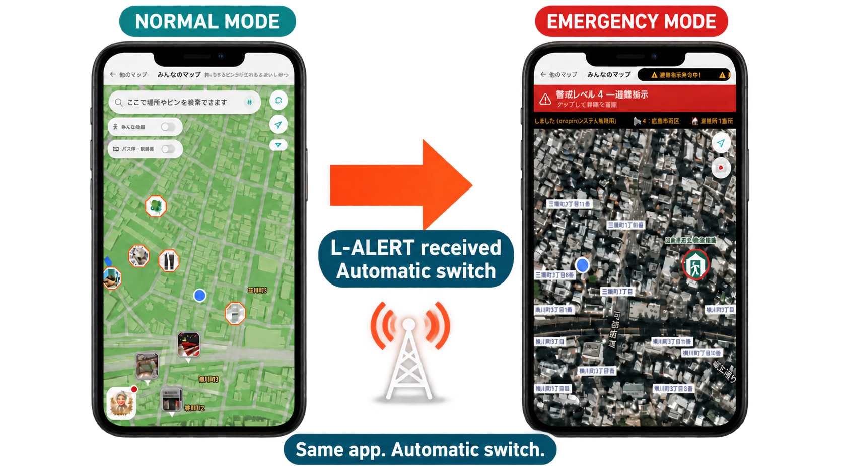
01 /WHAT YOU CAN DO
Features & Use CasesOverlay published flood projections on streetscapes at selected locations in Hiroshima Prefecture. You can also view landslide warning zones on the map.
When evacuation information at Alert Level 4 or above for the target area is received via L-ALERT, the map automatically switches to disaster mode.
View your current location, areas subject to evacuation and open evacuation shelters on the map. Approximate walking routes and multilingual displays help keep visitors informed.
Share your current location or a meeting point with your family via a URL sent through LINE or SMS.
02 /DESIGNED FOR YOUR PURPOSE
Ways to use droptip.
Hazard View displays published projections for reference and does not show actual water levels. Availability depends on display, communication and information reception conditions. Route displays do not guarantee safe evacuation routes, and "I'm Here" does not guarantee automatic safety checks or rescue arrangements. During a disaster, check the latest information from local authorities and the conditions around you, and take appropriate evacuation action.
EXPLORE MORE
LET’S MAKE CONNECTIONS
Tourism, events, and community connections.
Turn your ideas into a map.